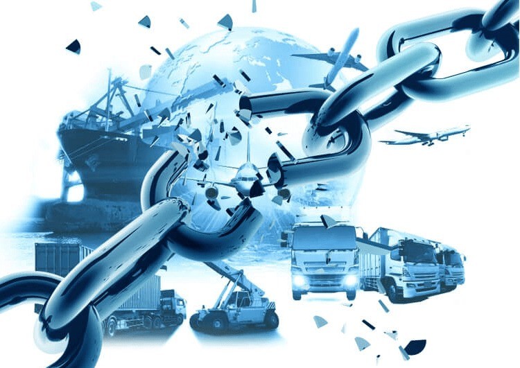
Charting Geospatial Technology’s Impact On Supply Chains
Shravan Kumar, Senior Director of Client Success at Gramener -A Straive Company
The idea of geospatial data and location intelligence is not new—the first recorded instance of using this technique dates back to the early 19th century.
 In recent years, particularly alongside the advent of AI, there’s been a boom in demand and interest for geospatial technology. One example is soaring demand in Saudi Arabia—recent insights from PwC reveal that the geospatial analytics market will reach $570 million by 2029.
This is because, for the supply chain sector, geospatial technology is proving to be a cornerstone solution to navigating geopolitical and climate disasters, such as the recent Red Sea blockade or the devastating earthquake in Japan.
Let’s hone in on the specific benefits of this constantly evolving technology and how organizations can best leverage it to transform their supply chain management.
Future-Proofing Supply Chains For Greater Resilience
Geospatial technology and location intelligence are revolutionizing four key areas: smart mobility, load planning, risk monitoring, and strategic site selection. These directly address some of the supply chain’s greatest challenges.
For the sector, reducing waste and cutting down costs is king, whether it’s minimizing emissions or empty miles. These issues bring major financial and reputational repercussions on businesses if not managed properly.
Tools like location intelligence and geospatial technology are enabling supply chain managers to reduce emissions by planning routes and loads succinctly. These technologies allow them to visualize routes, identify potential bottlenecks, and optimize how networks are mapped out.
Moreover, geospatial technology is also helping manufacturers unearth where the most value can be derived when planning routes to maximize financial benefits and avoid empty miles. This also involves pinpointing how to best deliver goods or supplies according to demand while keeping costs and climate top of mind.
Reducing Risks On The Road And Managing External Threats
Supply chains are rife with risk—they operate through uncontrollable factors like the weather and geopolitics. Having actionable, real-time insights is key to ensuring the best responses to situations like these that may arise and significantly disrupt operations.
Geospatial technology is capable of yielding these insights by leveraging satellite imagery, GPS data, and geographic information system (GIS) data, which are usually integrated into location intelligence systems. This technology enables managers to enhance their supply chain’s overall adaptability when faced with hazards.
For example, geospatial technology helps supply chain managers avoid hefty fines that are otherwise incurred if customer service-level agreements (SLA) are not met. It helps predict delays and provide real-time visibility of in-transit goods to manage timelines and SLAs based on various factors such as weather, drivers, routes, customers served, and sustainability commitments.
Importantly, geospatial AI can be leveraged to baseline, record, and measure risks like carbon emissions. For instance, geospatial AI analyzes embodied and operational carbon emissions by applying data based on type, distance, and routes traveled by a company’s fleet. Another example is satellite constellation technology, which can be used to detect fugitive methane emissions. This technology empowers organizations to track and measure Scopes 1 and 2 emissions.
A further benefit derived from geospatial technology is enhanced safety management. To illustrate this in action, the technology can notify teams when certain routes are more dangerous. If an accident does occur, it can alert central teams about the driver or team member’s location through satellite tracking systems (GPS) to power swift response.
Additionally, supply chain managers can monitor driver performance and safety by fusing telemetry data with other geospatial data, such as optimal routes between various points. They can also trace whether drivers are following speed limits, lane discipline, and other safety guidelines. This information can be used to power real-time alerting for drivers via their dashboards.
The AWS Sagemaker Geospatial Platform: A Game-Changing Solution
The sheer size of datasets yielded by geospatial technology is enormous. This is a significant problem in itself, as it can be extremely time-consuming and labor-intensive to sift through all this data.
That’s where the AWS Sagemaker Geospatial Platform steps in, featuring AI capabilities to alleviate data handling pains. This platform includes customizable analytics and visualization tools with personalized dashboards, allowing data scientists to do on-the-fly analyses and visual presentations of these. Moreover, it allows scientists to course correct if needed, which is otherwise a significant problem when conducting these analyses. These are transformative to enabling data-driven decision-making, particularly in acute instances where swift action is necessary. Moreover, this solution breaks these insights down from complex datasets so that they’re clear and digestible for teams.
The platform also integrates machine learning (ML) models to analyze geospatial data and provide predictive analytics like demand forecasting and route optimization. The AWS Sagemaker doesn’t come with the headache of integration processes—it supports real-time data streaming and integration, enabling dynamic adjustments in supply chain operations. It also functions seamlessly with other AWS services, comprehensively processing, analyzing, and storing complex data for organizations.
Finally, the AWS Sagemaker is facilitating widespread access and the democratization of data for analysis. The data it provides includes, but is not limited to, satellite imagery via APIs, digital elevation models, digital surface models, and more.
Effective Geospatial Technology Adoption
In creating the blueprint to adopt this technology, supply chain managers first need to identify strategic and operational objectives. This involves gauging current weak spots in existing processes and understanding where improvements can be made to augment the overall resilience and risk management of the supply chain.
Once benchmarks have been established, managers can proceed to select the right solution for their needs. It’s crucial to choose a platform that can handle large datasets and can be easily integrated into existing systems.
Notably, geospatial data needs to be regularly updated and verified to optimize the accuracy of data handling. Implementing flows and pre-scheduling updates regularly can ensure this is maintained.
Additionally, companies must train teams through immersive workshops on using these new tools. Simulations are a great way of increasing awareness of geospatial technology use cases in real-life situations so if a crisis does occur, supply chain teams are sufficiently prepared to manage it. Moreover, teams should be well-trained in understanding insights garnered from the technology so these can be constructively utilized to bolster supply chain operations and outputs.
Looping back to the predefined operational and strategic goals, it’s imperative to monitor how this technology is performing. Based on results against benchmarks, teams can make adjustments to how this technology functions in managing supply chain operations and performance.
Geospatial technology is shaping the future of supply chain management and optimization to keep ahead of regulations, manage carbon emissions, and avoid crises. As supply chains only become more complex as consumer demand continues to climb, solutions such as the AWS Sagemaker Geospatial Platform will be pivotal for supply chain managers looking to maximize their performance.